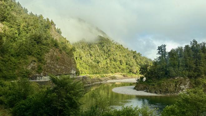
We had a long travel day from Nelson to Franz Josef, leaving at 7:15 am with a scheduled arrival just after 5 pm. Fortunately there was lots to look at out the windows of the bus, and several interesting stops along the way. Our route was initially in the interior, following a river valley.
Once we got to Westport, the route was almost entirely along the coast.
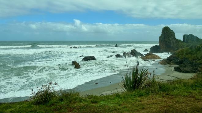
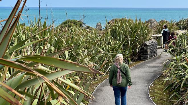
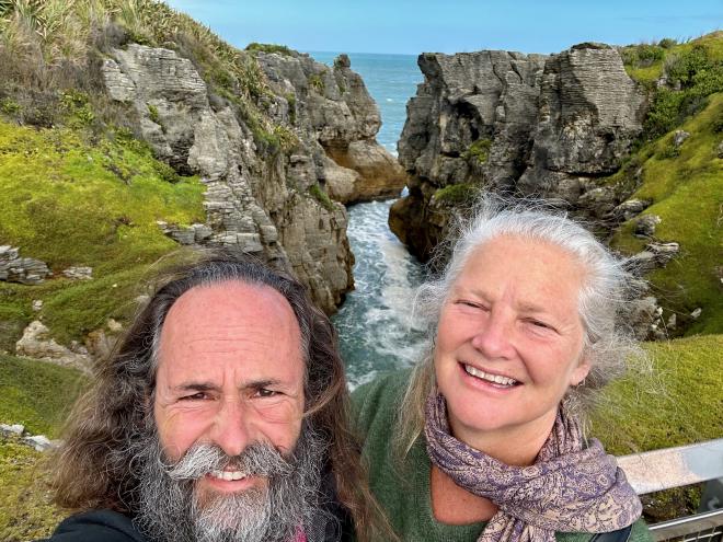
At noon we stopped for half an hour in Paparoa National Park at Punakaiki, home of Pancake Rocks. This gave us enough time for a quick visit to the Rocks and blowholes, which are reached via a well-maintained path through native vegetation, including this harakeke.
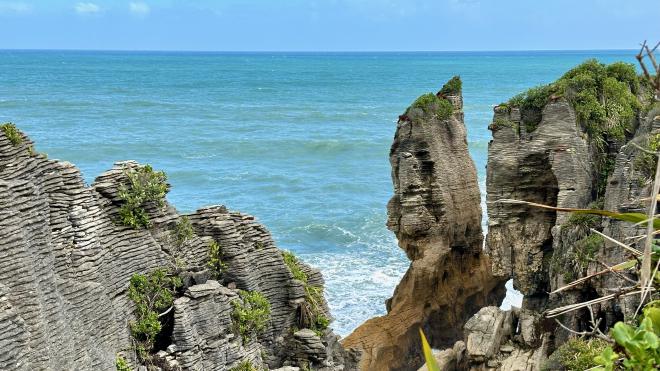
The Pancake Rocks get their name from… well, see for yourself.
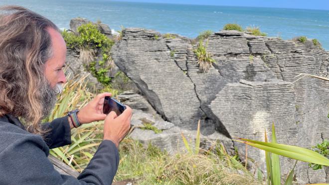
Greg took rather a lot of pictures of the geology.
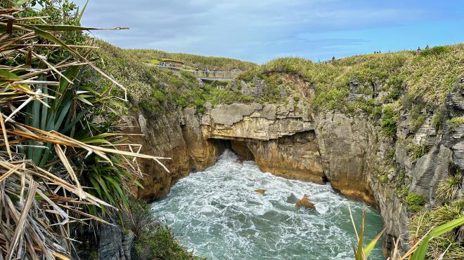
Among the rocks are inlets that let the surf come crashing in.
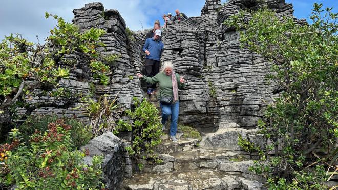
Some parts of the path are more challenging than others.
This is one of the inner pools at Pancake Rocks. When the tide is high and the surf is up, the water comes shooting up through blowholes in the rocks. Conditions weren’t quite right for that during our visit, but it was still spectacular.
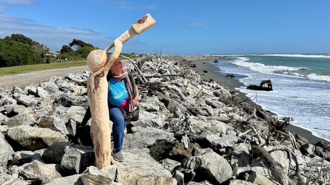
Mid-afternoon we had another stop in the town of Hokitika, where we had time for a bit of a wander along the rocky beach. Karen wasn’t able to figure out what this fellow was so interested in looking at through his telescope.
We got into Franz Josef about an hour behind schedule and were dropped off quite close to the Chateau Backpackers and Motel, where we were staying. After checking into our room, which was a quite comfortable efficiency studio, we went out for dinner, some grocery shopping, and a walk around town.
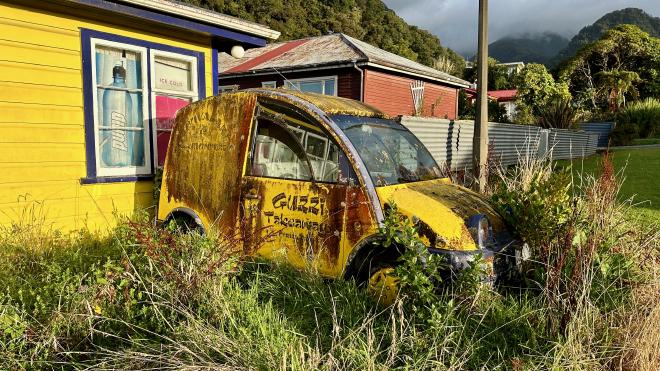
We think this abandoned car may be the same model that our friend David Aiken, The Checkerboard Guy, has at the front of his property on Vancouver Island.
Our grocery shopping yielded this rather over-the-top bag of Great Uncle Kenny’s Amazing Snacka•Changi Chips, which we bought mainly for the label. Fortunately, the chips inside turned out to be quite tasty.
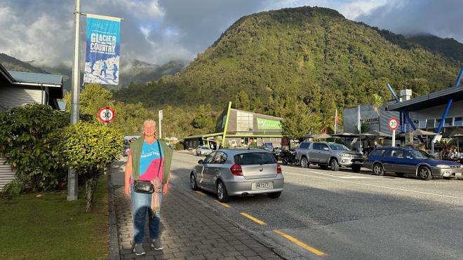
The next morning was a bit gloomy, and we had no fixed plans, so we stayed in the motel room and caught up on some work and maintenance. By afternoon it had cleared, so we headed out to find a souvenir magnet and see the area adjacent to the Franz Josef townsite.
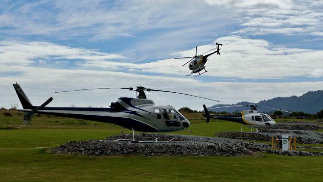
These days, the only way to actually get to onto the glaciers without a two-day hike is by helicopter. At over $600 per person for a short visit, we weren’t particularly tempted, but apparently lots of people shell out for the experience – the airfield had a constant flow of helicopters landing and taking off. This is just a small part of the field; we counted about a dozen gravel pads.
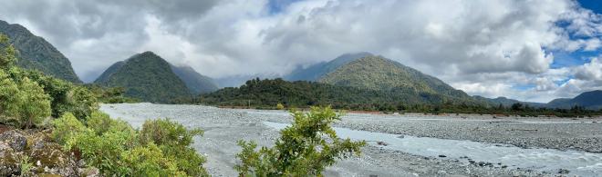
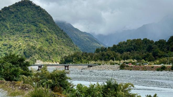
Franz Josef is beside the Waiau River, which is fed from the Franz Josef Glacier and mountain runoff. It floods quite frequently, so there’s a large dike between the river and the town.
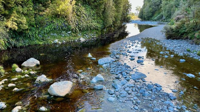
This is the river itself. During our visit the flow was fairly low.
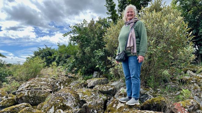
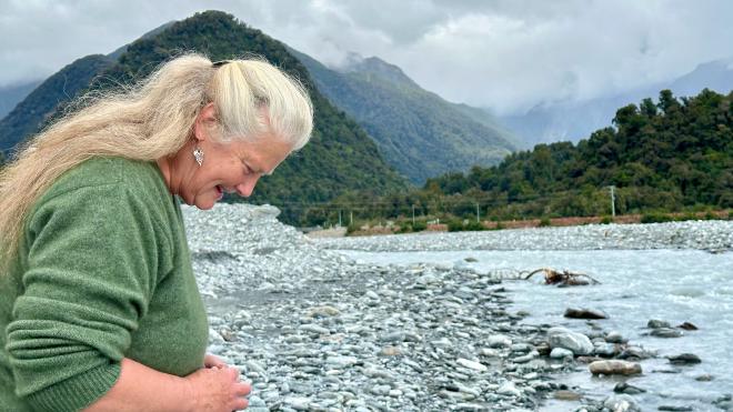
Of course Karen had to go down and hunt for an interesting rock.
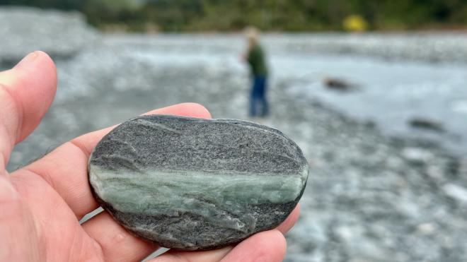
This was probably the nicest one we found, with a vein of Pounamu or Greenstone in the middle. Unfortunately it was a bit large to pack.
We walked along the top of the dike towards this bridge, which is on the only highway that runs north-south along the west coast of the island. It washed out completely in March of 2019 and was replaced within two weeks by New Zealand’s Army Engineers.
The next day we had booked three walking tours back-to-back with Glacier Valley Eco Tours, to Franz Josef Glacier, Fox Glacier, and Lake Matheson. It was a long day, running twelve hours from 9:30 am, but turned out to be well-worth the time and exertion.
After signing in and getting kitted out with with waterproof trousers and hiking boots (we already had good rain jackets), we hopped in the van with our guide and headed up to our first hike.
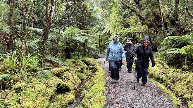
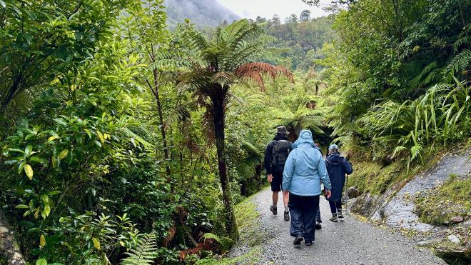
The day had started off very wet, which is typical for the west side of the mountains. You can see that the moss, ferns, and other vegetation love all the moisture; the people, perhaps not so much. Since the mountain was completely cloud covered, we took a side trip along the Roberts Point Track in hopes that things would clear before we got to the glacier lookout.
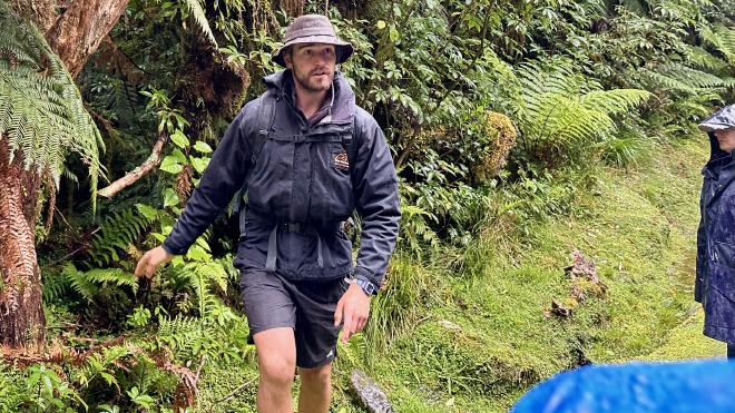
Our guide, Jared (no relation to our eldest child) was in shorts, which made us feel chilly but seemed to work for him. Of course, he was carrying a large backpack with the emergency gear and other supplies, so he was working a lot harder than us. He was quite knowledgeable about the local flora, fauna, and geology, and we took frequent stops for him to point out things of interest.
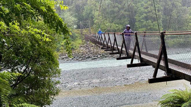
Our path led us out to this swing bridge over the Waiau River. As you can see, it was raining quite hard by this point. Notice the different colours of water in the two channels. The blue-green water is straight from the glacier. The brown water is rain that’s come down through the vegetation, picking up tannins from the soils along the way.
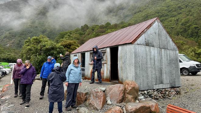
We went back to the van and headed up to the parking lot for the main Franz Josef trail. This building is Defiance Hut, which was built between 1912 and 1913 on Defiance Ridge, well up the glacier. All the materials had to be carried in by hand. It was relocated from the side of the ridge to the ridge crest in 1936 when the receding glacier and erosion put it in danger of collapse, again all by hand. The hut was used until 1974, then moved by helicopter first to Franz Josef townsite and then to its current location, as something of a museum piece.
The interior of the Hut is furnished roughly as it would have been in the early 1900s.
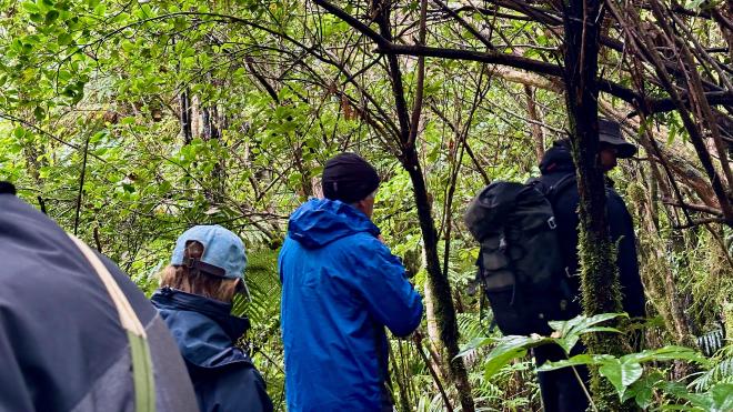
We started on the main trail, but switched to a semi-hidden, narrow, twisting trail that’s reserved for guided tour groups.
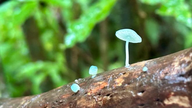
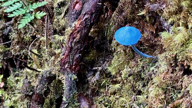
On the trail Jared pointed out this blue mushroom, which is a native New Zealand fungus and is found on the New Zealand fifty dollar note.
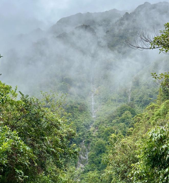
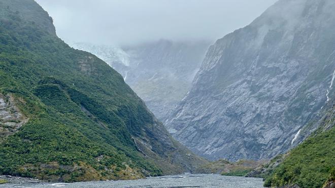
We had beautiful views of waterfalls through the mist on our walk to the glacier viewing point.
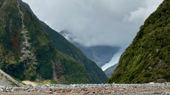
Unfortunately, the clouds were still most of the way down the mountain by the time we reached the viewing point, which is the closest you can get to Franz Josef Glacier on foot. You can just see it on the left, peeking out above the green hill and below the clouds. In 1908, the glacier extended all the way down to the point from which this picture was taken. At the rate it’s retreating, the glacier will likely be completely hidden from the viewpoint in just a few years, and may be entirely gone by 2050.
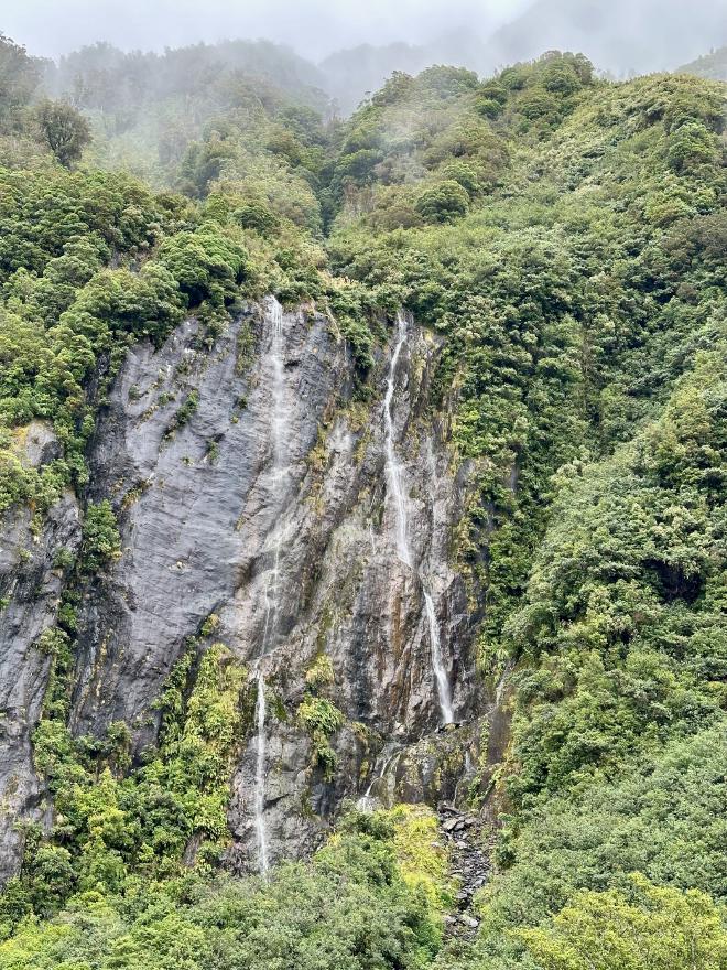
In addition to the glacier, there were also more waterfalls to enjoy from the lookout. While we admired the view and took photographs, Jared broke out thermoses of hot water, mixes for coffee, tea, and hot chocolate, and a bunch of chocolate chip cookies for us to enjoy.
We hiked back down the main trail, rather than the twisty one we’d come up. By this time the rain had completely stopped, the cloud was starting to lift, and it looked like we might be in luck for the afternoon.
We took the van back to the townsite, and the two of us had a nice warming lunch at the Full of Beans Cafe next door to the tour office. Greg ordered the Full of Beans breakfast and was disappointed when it didn’t actually include any beans – ’though it was in all other ways delicious.
After lunch we hopped back in the van with Jared and a completely new group of tourists – it turned out we were the only two who had booked all three tours back-to-back that day. The drive to Fox Glacier was quite a bit longer, and we stopped in the Fox Glacier townsite to pick up some other group members.
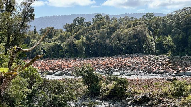
The hike from the Fox Glacier parking lot to the lookout was quite a bit longer than the hike for Franz Josef, so we had no time for side trips. This is the river that comes down from the glacier. The red colouring on the rocks is blue-green algae (yes, we know) and indicates that those surfaces have been dry for at least two years. As you can see, the weather was starting to clear, so it looked like we might have good views.
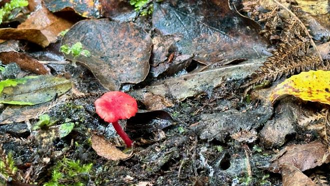
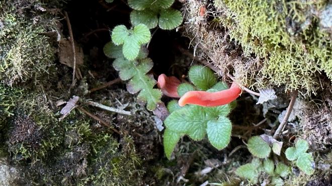
Once again we took a “guided tours only” trail up to the lookout. This went through dense rain forest, and gave Jared lots of opportunities to point out plants and fungi along the way, including this red mushroom…
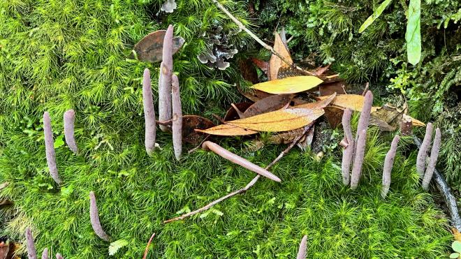
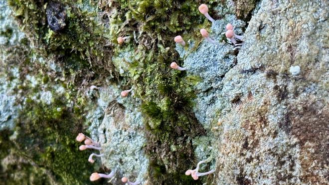
… these finger mushrooms…
… and these vaguely castle-shaped mushrooms.
By this point most of us had unzipped our jackets and Jared was down to his t-shirt.
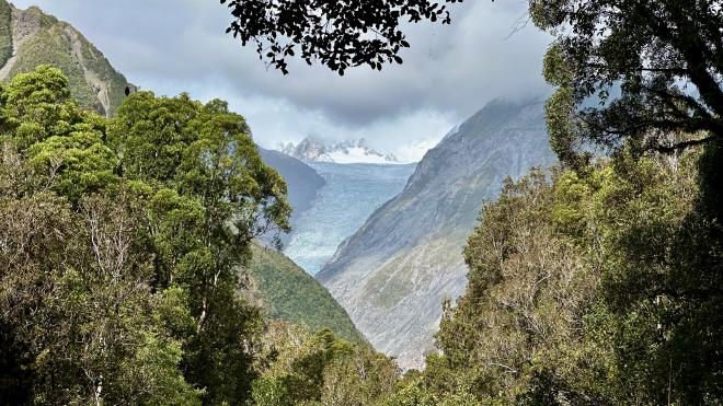
As hoped, our hike was rewarded with good views of Fox Glacier, which is quite a bit more exposed than Franz Josef. It is actually possible to hike to the glacier itself, by following a multi-day path on the other side of the river valley from the route we took.
From the lookout we headed down to the dry part of the river bed, for a different view of the glacier. The clouds had closed back in a bit, but the lower tongue of the glacier was still visible.
One of the other members of our group took this shot for us.
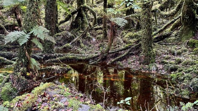
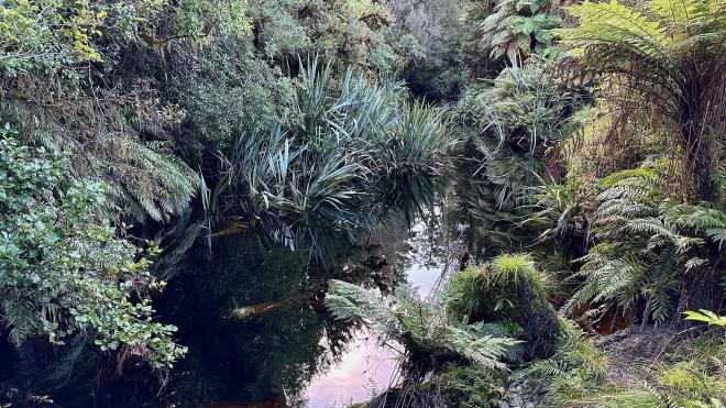
We went back via the main trail, with a short side trip to visit this tannin-darkened pool.
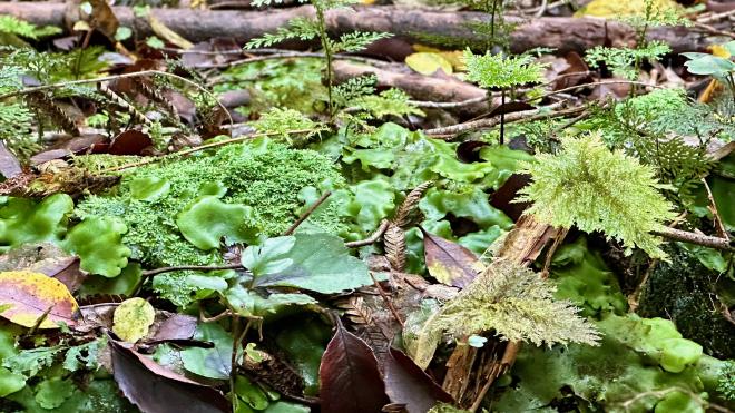
We also saw some very tiny and delicate moss and ferns.
Our third tour of the day was Lake Matheson, also led by Jared. Lake Matheson is much closer to Fox Glacier than Franz Josef, and several of us from the Fox Glacier tour were headed to Lake Matheson. So, rather than drive us all back to Franz Josef and then out again, the tour company sent another van to meet us near Lake Matheson.
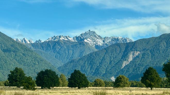
The other van was running a bit late, so we had a chance to go to a lookout with a good view of the highest peaks of the Southern Alps. This isn’t that view; this is a shot from the van.
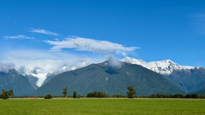
This is the view from the lookout, called Te Kopikopiko o te Waka or “the canoe capsized.” Māori legend tells that the sons of the sky father, Raki, were on their way back from a visit to the earth mother, Papatūānuku, when their canoe capsized. The upside down canoe became the South Island, and the brothers, who had scrambled onto its top, became the tallest peaks of the Southern Alps. Aoraki, Raki’s eldest son, is the mountain also known as Mount Cook. At left you can see Fox Glacier. Mount Tasman is just to the left of the central green hill, shrouded in clouds, and Aoraki Mount Cook is to the right.
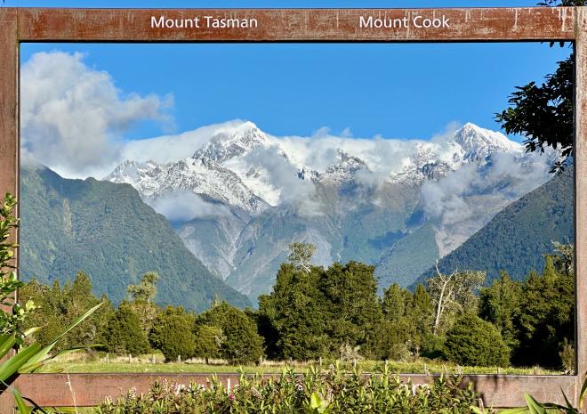
We drove from the lookout to the Lake Matheson parking lot, where group members from the afternoon tour left us and a few joined us for the evening tour. This handy frame, just down the trail from the parking lot, helps you figure out which mountain is which.
Lake Matheson is fed by rain water, rich in tannins, so it’s a dark brown colour.
Along the trail, which circles the lake, Jared continued pointing out interesting plants and fungi, like this red finger mushroom…
… and these tiny ones.
We also found another blue mushroom, this one quite a vivid colour. They are only found a few weeks out of the year, so we were very lucky with the timing of our visit.
Many streams feed into the lake, this one lined with ferns and harakeke.
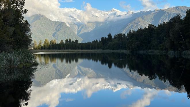
Aside from the lovely nature walk, the main reason to visit Lake Matheson is to see the mountains reflected in its surface. Because of its dark brown colour, it’s a marvellous mirror – as long as there’s no wind to ruffle the surface. The wind normally dies down briefly around sunset, but you never know. At this point there were still quite a few ripples.
We continued our walk to another vantage point, passing many small waterfalls along the way.
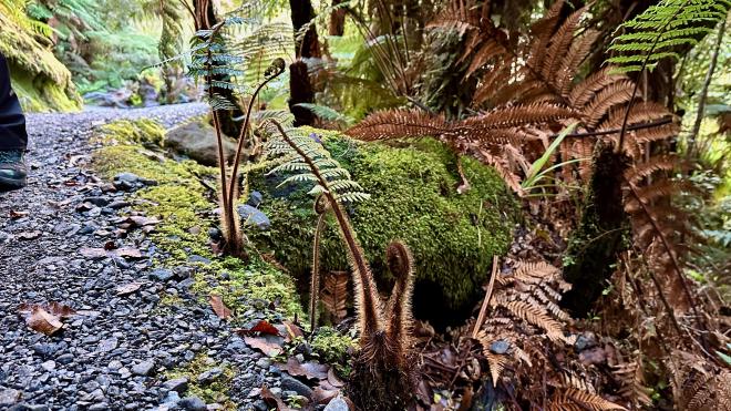
These are shoots of the fern tree, which can grow extremely tall. You can see one in the last photo in the Franz Josef section above, and some much taller ones in the first photo on 20 February in the Waitomo and Raglan diary entry.
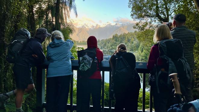
We spent about half an hour at a viewpoint right down by the lake, where we ate some snacks we’d brought with us and Jared broke out the hot drinks and cookies. It was a very pleasant and relaxing interlude, but unfortunately the wind and some ducks conspired to ripple the surface and the perfect photograph continued to elude us.
Jared took us up to a higher lookout, in case the change of angle would help…
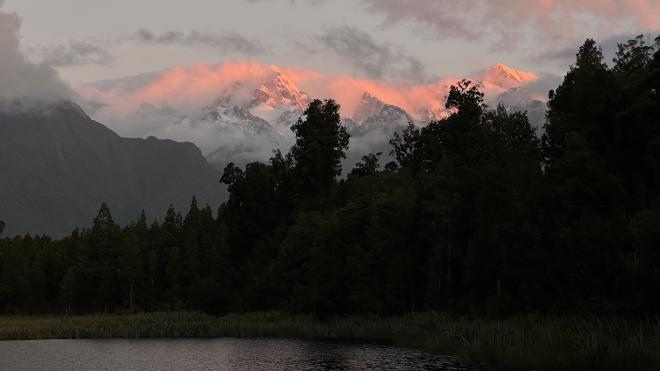
… but the ripples continued. We were starting to lose the light, so we reluctantly headed down to continue our walk around the lake to the car park.
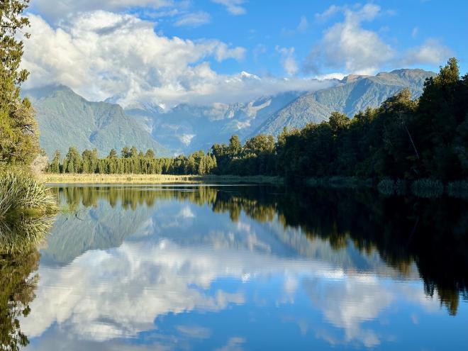
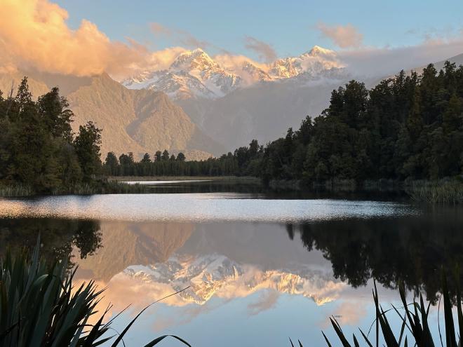
Just as we got to the bottom of the lookout stairs, Greg realized that the wind was off the near edge of the lake and the clouds had blown away from the peaks. He ran back to our second-last viewpoint, where he was able to snag this lovely shot.
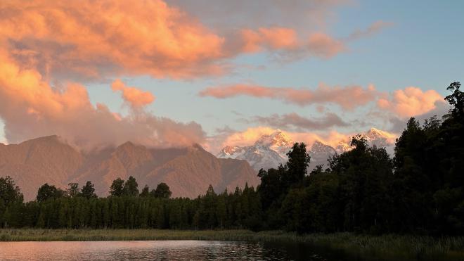
The sun began to set during the last of our walk, giving the clouds and mountains a lovely glow.
The last light on the peaks was a beautiful pink.
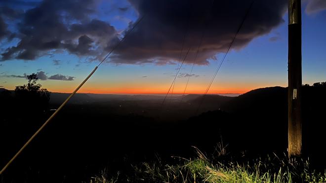
During our drive back to Franz Josef, Jared pulled the van to the side of the road at a high spot so we could watch the final moments of sunset over the ocean.
After our rather full day, we went back to our hotel room, packed up for an early morning departure, and got a well-deserved good night’s sleep.